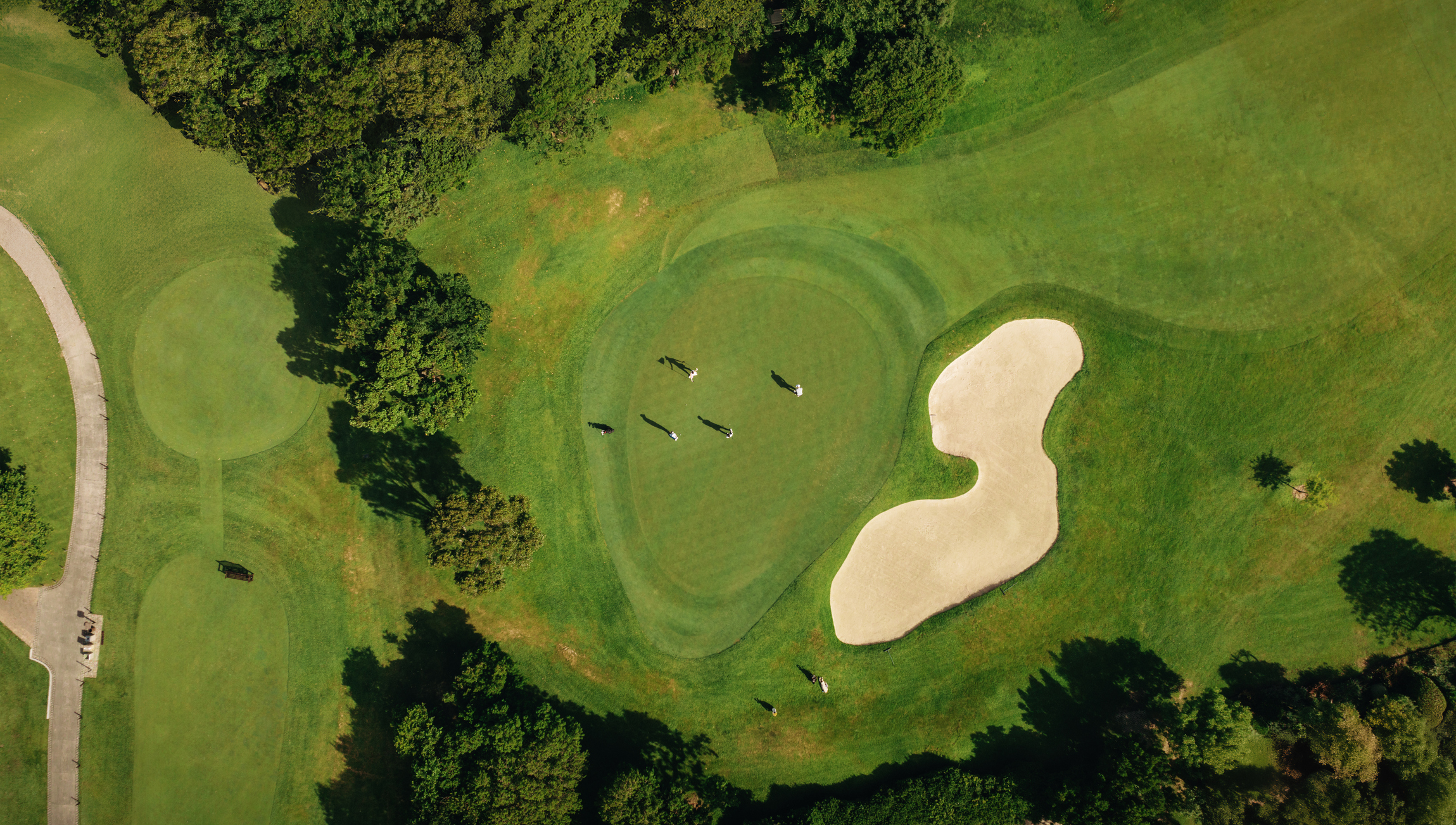
Golf course design has always been an art—but now, it’s also a highly technical process. Architects still bring strategy, creativity, and the designer’s eye, but today they also need data, accuracy, and visual tools that make it easier to understand the land and communicate ideas clearly. And this is exactly why 3D golf course modeling has become such a powerful part of the modern design workflow.
With the help of drone photogrammetry, golf course LiDAR mapping, and 3D visualization software, architects can explore a site digitally long before construction begins. They can analyze terrain, model green complexes, preview fairway shaping, and show clients a realistic view of the course in a way that 2D plans simply can’t match.
In other words:
3D models bring the land to life, before anyone brings an excavator onsite.
In this article, we’ll dig into why 3D mapping and visualization have become essential tools for golf course architects, how the technology works, and how it helps teams catch issues early, present concepts with clarity, and design more confidently. We'll also explore why partnering with a professional golf course design mapping specialist can make all the difference.
The Rise of 3D Mapping in Golf Course Architecture
The shift from 2D drawings to fully interactive 3D models didn’t happen overnight. But as clients and stakeholders demand clearer presentations—and construction budgets get tighter—the need for accurate, digital representations of the land has become much more important.
Traditional topographic surveys, contour maps, and hand sketches are still useful, of course. But they don’t deliver the full picture. They can't show how a ridge affects visibility from the tee, or how a green sits in a natural hollow, or how subtle a fairway transition feels when you stand on the landing area.
3D golf course mapping and visualization changes that.
Using drone imagery, LiDAR scans, and advanced modeling software, architects now have the ability to:
- Rotate and view terrain from any angle
- Test multiple routing options
- Preview sun and shade patterns
- Identify problem areas early
- Show clients exactly how the course will look
- Make more informed grading and drainage decisions
- Prepare construction teams with precise data
Ultimately, 3D modeling streamlines the entire design-to-construction pipeline and reduces surprises in the field—something every architect, contractor, and developer appreciates.
How Golf Course 3D Modeling Works (Explained Simply)
You don’t need to be a surveyor or GIS expert to understand how 3D modeling comes together. Here’s a straightforward overview:
1. Drone Surveys Capture the Site
First, mapping professionals send up drones equipped with:
- High-resolution cameras
- LiDAR sensors (for precise elevation)
- RTK GPS for centimeter-level accuracy
The drone flies automated routes, capturing thousands of overlapping images or laser measurements.
2. The Data Is Processed Into a 3D Terrain Model
The imagery and LiDAR data are combined into:
- Point clouds
- Digital Elevation Models
- Digital Terrain Models
- Orthophotos
- Accurate contour maps
This is the digital canvas on which architects design.
3. The Model Goes Into Design Software
The processed data is brought into CAD, Civil 3D, or golf design platforms, where architects can:
- Trace routings
- Model green complexes
- Plan grading adjustments
- Shape bunkers and fairways
- Run drainage simulations
- Produce 3D visualizations and renderings
This is where golf course 3D modeling becomes a powerful creative and technical tool.
Why 3D Golf Course Modeling Has Become a Must-Have for Architects
1. It Helps You Truly Understand the Terrain
Topographic maps are helpful, but they force you to imagine elevation changes instead of seeing them.
With 3D golf course mapping and visualization, you can:
- “Fly” through corridors and green sites
- Zoom in to study subtle contours
- Rotate features to understand their relationships
- Compare different design options in seconds
- See how slopes affect playability and drainage
Suddenly, you’re not just interpreting lines on a page—you’re experiencing the land as players will.
2. You Catch Problems Before They Become Expensive
One of the biggest value-adds of golf course LiDAR mapping is early detection.
For example:
- A green site that seems flat on a topo map may actually pitch the wrong way.
- A tee box may sit on unstable soil or at an awkward angle.
- Natural drainage paths may conflict with proposed bunkers.
- Fairway shaping may require more cut-and-fill than anticipated.
With precise 3D models, architects can run simulations, check slopes, and spot problem areas early—long before construction crews mobilize.
3. It Dramatically Improves Client Presentations
Let’s be honest:
Not all clients understand contour maps.
But everyone understands a 3D rendering.
By incorporating 3D golf course mapping and visualization, you can show stakeholders:
- Realistic course flyovers
- Before-and-after elevation comparisons
- 3D green complexes
- Routing visuals
- Grading concepts
- Photorealistic hole previews
This makes design meetings more engaging, reduces confusion, and speeds up approvals.
4. You Communicate Better With Contractors and Engineers
Construction teams love 3D models because they clarify expectations and eliminate guesswork.
When contractors have access to accurate golf course design mapping, they can:
- Follow grading plans more precisely
- Understand how each feature should sit
- Use machine control systems with confidence
- Avoid reshaping work in the field
It’s not just a tool for visualization—it’s a tool for execution.
5. It Supports More Sustainable, Environmentally Responsible Designs
Sustainability is becoming a major priority in course design, and 3D models help architects:
- Understand natural drainage
- Avoid excessive earthmoving
- Protect sensitive areas
- Plan efficient irrigation
- Reduce environmental impact
Seeing the land clearly leads to better decisions all around.
How 3D Modeling Improves Routing and Design Flow
Routing is one of the most challenging—and rewarding—parts of golf course architecture. With 3D modeling, architects can compare possible routings easily and evaluate:
- Strategic shot values
- Hole-to-hole transitions
- Walkability
- Visibility from tees
- Aesthetic views
- Natural hazard placement
- Wind direction factors
Instead of relying on experience and intuition alone, 3D models provide concrete information that supports better design outcomes.
Long-Term Value: 3D Models Aren’t Just for Design
Once construction is complete, 3D models continue delivering value for:
- Future renovations
- Drainage upgrades
- Irrigation improvements
- Turf management planning
- Monitoring erosion or settlement
- Documentation for ownership groups
The model becomes a long-term reference asset for the entire life of the course.
Why Work With a Professional Golf Course Mapping Company
Although 3D modeling tools are more available now than ever, building accurate, usable terrain models requires specialized skill in:
- Drone data capture
- LiDAR surveying
- GNSS control setup
- Data processing
- Terrain modeling
- GIS analysis
- Integration with CAD and golf design software
A professional partner like GeoGolf ensures that your data is:
- Accurate
- Fully geo-referenced
- Architect-ready
- Compatible with your design workflow
We don’t just deliver maps—we deliver insight that supports your creativity, efficiency, and design precision.
Conclusion: Designing With Confidence Through 3D Visualization
3D golf course modeling is transforming how architects design, present, and refine course concepts. It gives you a clearer view of the land, helps you solve problems before they escalate, and provides a powerful communication tool for clients and construction teams.
With golf course 3D modeling, 3D golf course mapping and visualization, golf course LiDAR mapping, and expert golf course design mapping, architects can design smarter, build more efficiently, and bring their vision to life with confidence.
Bring Your Vision to Life With GeoGolf
If you're ready to design a course with better insight, stronger visuals, and more precise data, we’re here to help.