
Golf Course Topographic Surveys and Mapping for Design, Renovation, and Construction
Capture contours, elevations, drainage patterns, and site features with dependable survey data for master planning, renovation design, construction, and green-complex decisions.
Topographic Surveys for Design and Renovation
For architects, superintendents and construction teams defining grading, green restoration, drainage and renovation work. Start with the area to be mapped and the decisions the survey needs to support.
Not sure which survey, mapping method, or accuracy level you need? Describe the course and what you are planning. GeoGolf can help identify the information needed before a formal scope is prepared.
Deliverables to Agree
- Course basemaps, elevations and contours with agreed golf features.
- Green and bunker contour or slope maps where included in the scope.
- AutoCAD drawings, aerial overlays, area calculations and terrain models as specified.
Scope and Inclusions
The published BASE package starts at $5,900 and PLUS package at $11,900, excluding travel expenses. These are starting packages, not a quote for every property. Confirm acreage, features, contour interval, coordinate system, formats and project limits before comparing proposals.
Cost Drivers
Area and access, vegetation, required control and verification, green/bunker detail, additional site visits, aerial coverage and travel affect the scope and estimate.
Questions Before Ordering
What area do the package prices cover?
The current published packages do not state a universal acreage allowance. Ask GeoGolf to confirm the mapped boundary and any exclusions in your project estimate.
Can the survey be scheduled around play?
Include access restrictions, tee times, seasonal conditions and your required delivery date. Mobilization, field access and the delivery schedule are agreed for the project; no fixed turnaround is implied.
How should accuracy be specified?
State the design tolerance and required horizontal and vertical verification separately from contour interval. GeoGolf can discuss the capture and check requirements for the proposed use.
What to Send
Share the course location, approximate area, design phase, intended use and your architect's file requirements. Existing plans or a marked-up area are useful; the inquiry map is optional.
Image resolution, point density, contour interval, and independently checked horizontal and vertical accuracy describe different things. Specify the intended use, coordinate reference, site conditions, control and verification requirements in the proposal. A fine contour interval or a dense model is not a blanket accuracy guarantee. Terrain data supports drainage design; soil, infiltration, groundwater and geotechnical questions require separate investigation.
Related Project Work and Guidance
Green Complex and Sand Bunker Contouring
1 Inch or 3 Inch Green Topography with 3 Inch or 6 Inch Green Complex and Sand Bunker Topography using Robotic Total Station combined with RTK GPS Control.
6 Inch or 1 Foot Course Topography
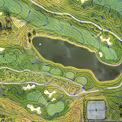
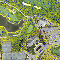
Overlay contour maps onto Aerial Photography with 1 Foot course contouring including all golf features, areas and basemap.
Core TOPOGRAPHIC Services
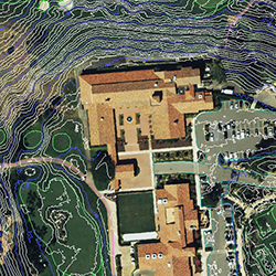
Course Topography
Course contours, golf features and basemaps for planning and renovation.
- Agreed site extent
- Contour and feature mapping
- CAD-ready drawings
Green and Bunker Mapping
Selected contour intervals and slope information for green-complex work.
- Green surface contours
- Bunker and complex detail
- Project-specific control and checks
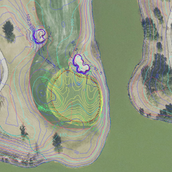
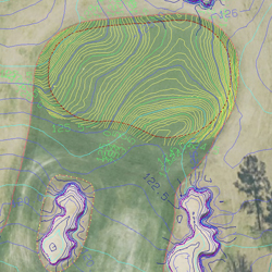
Green Scanning, Slope Maps, and Topo
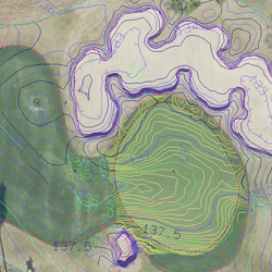
Green contour and slope maps provide elevation and surface information for analysis, archiving and reconstruction planning. Specify the required contour interval and independently checked accuracy for the intended use.
1", 3", 6" Green Contours
Survey methods to archive or reconstruct greens to the agreed specification.
Slope Maps of Green Surface
Precise slope percentage maps with HD Photography of Green Complex.
Survey Technicians
On-Site Survey technicians trained in survey, mapping and geodesy.
AutoCAD Deliverables
AutoCAD file structure and drawings at any scale (Typically 1 inch = 5 feet) plus Green Slope Maps.
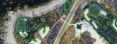
"We have worked with GeoGolf on several projects from 2008-2012 and they have consistently delivered the required products on time. Two notable projects include 400 acre topo of a new project site and an existing renovation that required 1-foot course contours, 6-inch bunker contours, and 1/10th foot green contours. We are very impressed with their work and will call them again."
Topographic Packages
Choose a focused survey scope or a complete terrain package based on your design phase, deliverables, and budget.
Topographic BASE Package
Essential Mapping & Design Foundation
Package Includes:
- Using Survey Grade GPS and Robotic Total Station for detailed 3D terrain model
- 6-inch contours of greens and greens complex areas
- Existing aerial imagery where suitable; new capture scoped separately
- All area square footage / acreage calculations provided by hole, front/back 9 and Course totals
- Hole maps and routing provided for budgeting and design
- Data provided in AutoCAD format for Architect and Contractor use and integration
Topographic PLUS Package
Comprehensive 3D Mapping & Concept Design Suite
Package Includes:
- Survey Grade GPS and Robotic Total Station for detailed 3D terrain model
- 6-inch contours of greens and greens complex areas
- Existing aerial imagery where suitable; new capture scoped separately
- All area square footage / acreage calculations provided by hole, front/back 9 and Course totals
- 3D concept plans of proposed course changes and routing
- High Resolution Printable Layered PDF files provided
Ready for Better Terrain Data?
Tell us about your course, design phase, and required deliverables. We will help define the right survey scope for your project.